Ultimate Guide to Backpacking Ptarmigan Ridge: Tips, Permits, and Best Campsites
I had been eyeing Ptarmigan Ridge for a while, originally as a day hike. However, with no plans for Labor Day weekend and a desire to explore the North Cascades after a summer in Olympic National Park, it became the perfect opportunity for backpacking. In Washington, snagging a permit for popular national park trails on a holiday weekend is notoriously difficult. Fortunately, the Mount Baker Wilderness offers a reprieve as it doesn’t require permits for most overnight stays. The only challenge was navigating the tricky parking situation at Artist Point. You can view my detailed route on AllTrails.
Permit Information for Mount Baker Wilderness
Today
66°F
Sunny
Tonight
54°F
Partly Cloudy then Slight...
Thu
62°F
Slight Chance Light Rain...
Today
66°F
Sunny
Tonight
54°F
Partly Cloudy then Slight Chance Light Rain
Thu
62°F
Slight Chance Light Rain then Slight Chance Showers And Thunderstorms
Thu Night
47°F
Showers And Thunderstorms Likely then Light Rain Likely
Fri
56°F
Slight Chance Light Rain
Fri Night
44°F
Partly Cloudy
Unlike North Cascade National Park, no permits are required to overnight camp in the Mount Baker Wilderness area. The only restrictions that apply are that campers must be at least 1 mile away from the junction with Chain Lakes Trail from May 15 to November 14. This gives you a ton of options on where to set up camp. Be sure to follow Leave No Trace principles and camp on durable surfaces. The good news is there are tons of well-established campsites along this route. On the map below, I’ve denoted the Ptarmigan Ridge trail in yellow and circled the no-camping zone in red.
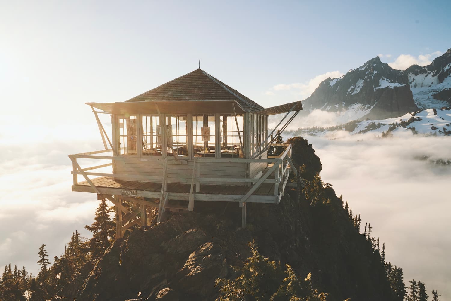
Getting to Artist Point Trailhead
The trailhead you will use to access Ptarmigan Ridge is located at Artist Point. The road heading to the trailhead is SR 542. You can get the latest report on road conditions here. During the winter, the last 2.7 miles of road to Artist point is closed. You can check the link provided to see when the road fully opens up. Depending on the snowfall levels, it could remain closed until early summer.
Artist Point parking area is very large but during weekends it can fill up quickly. You are required to display a Northwest Forest Pass in your car.
The Best Time to Hike Ptarmigan Ridge
Ptarmigan Ridge is often snow covered into early July so expect snowy conditions before July. Peak season is from July to October. By mid to lake October, you should start expecting the snow to fall.
Chain Lakes Loop to Ptarmigan Ridge Trail
From the large parking lot at Artist Point, start hiking on the Chain Lakes Trail. You’ll only be on this trail for 1.1 miles before splitting off to Ptarmigan Ridge. I love that the views start immediately on this hike. The first thing you see is the snow-capped Mount Baker in the distance. The trail skirts along the hillside with steep meadow slopes on both sides. In summer, the trail is dotted with wildflowers.
After 1.1 miles, you will come to a wooden post where the Chain Lakes Trail continues on towards your right and the Ptarmigan Ridge Trail starts towards your left. Stay left to continue to Ptarmigan Ridge. Remember that there is no camping along this section. You will have to hike an additional 1 mile from this intersection before you are free to camp.
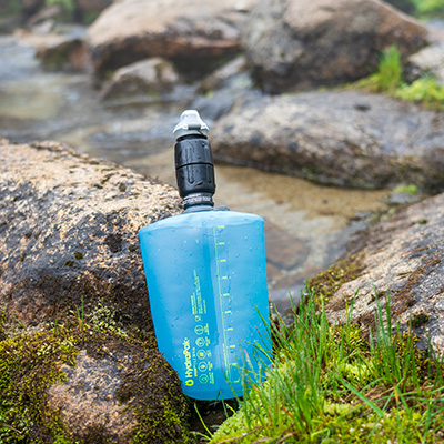
At this point on the trail, you will experience full sun exposure the rest of the way. You’ll definitely want to make sure you have sunscreen on. You will cross a few streams along this next section. Some of them you can actually hear running underneath the trail. I highly suggest hydrating at any and every stream you cross and topping off your water bottles. This is a must during the dryer summer months. The landscape here resembles something like a moonscape, which is really cool! Patches of snow dot the slopes.
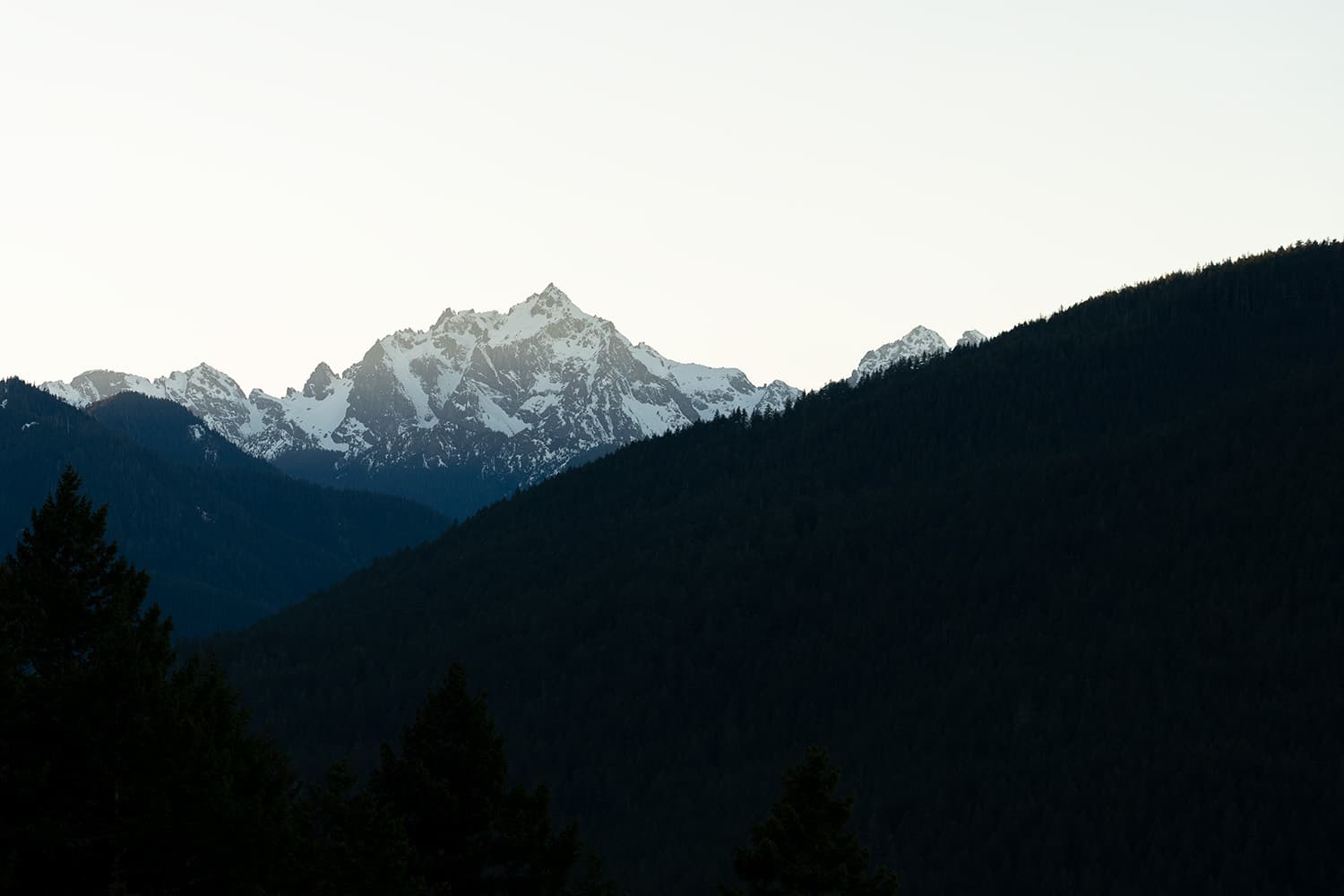
A mile after splitting off from the Chain Lakes Loop, the trail will swing left and head southeast, revealing Mount Shuksan. Renowned for its picturesque beauty and complex structure, featuring jagged pinnacles, steep glaciers, and a striking silhouette, Mount Shuksan is one of the most photographed mountains in the world.
For the next two miles, you will steadily gain elevation. Coleman Pinnacle Peak and Mount Baker dominate the landscape in front of you. The trail can be seen running along the rocky hillside terrain and stretches far out into the distance, disappearing into the landscape.
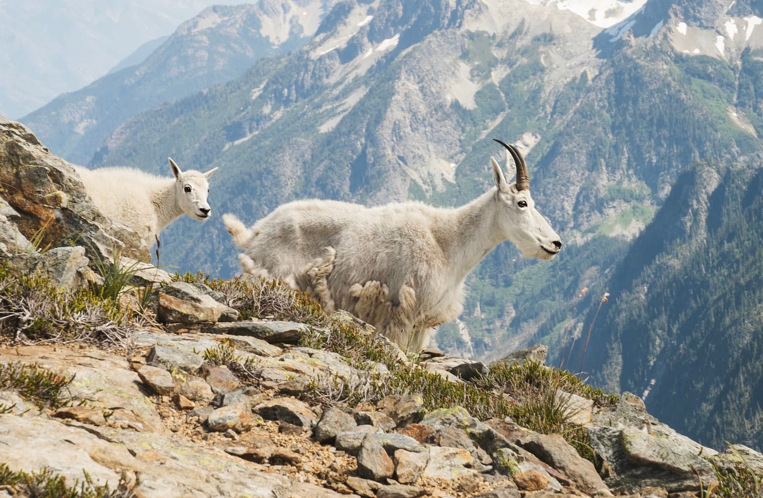
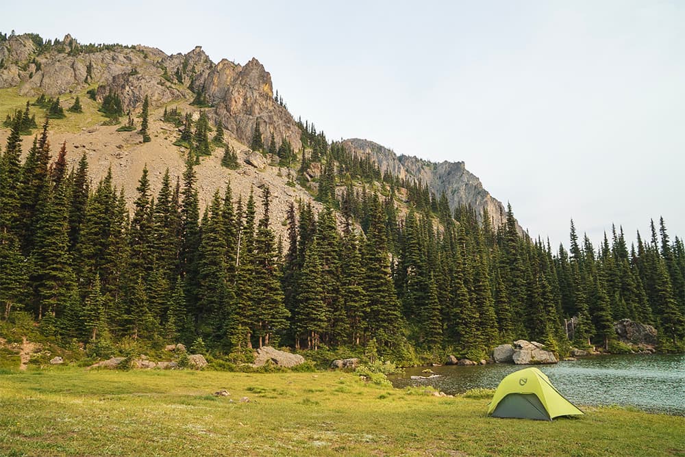
Below Coleman Pinnacle Peak is a great resting spot. From this area, you get a great view of Goat Lakes below. This is a popular spot for camping. Mountain goats also frequent the area.
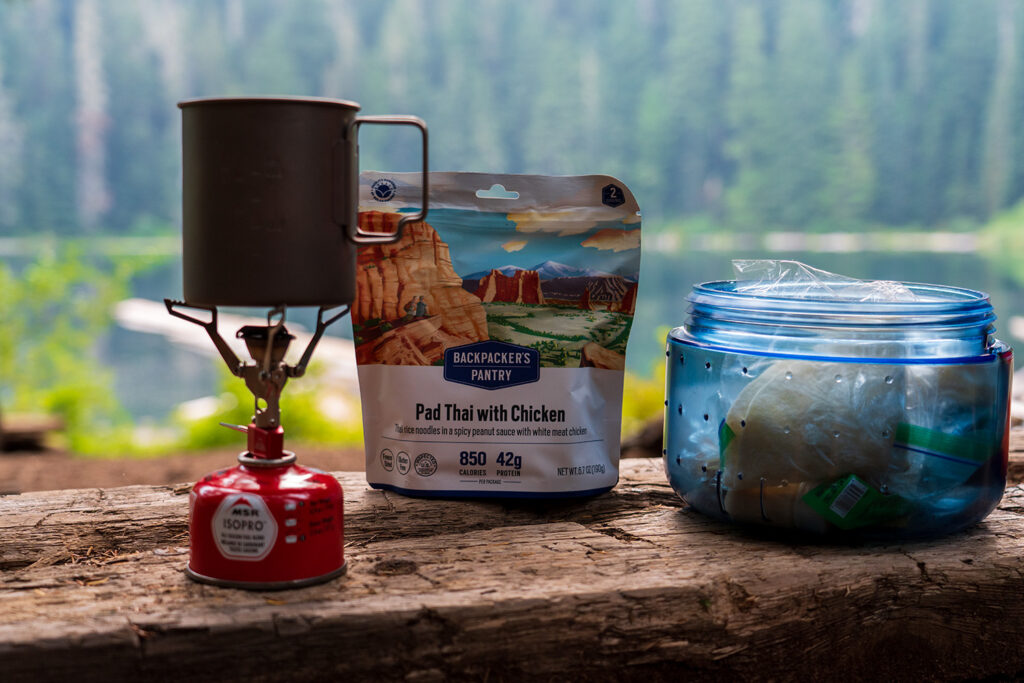
Kurt's Backpacking Gear
View My Full Gear List
Similar hikes worth exploring.
Continuing on the trail, you make a push higher in elevation just beyond Coleman Pinnacle Peak. The trail runs along the hillside meadows for the next mile, very gradually descending and then ascending back up. The lush alpine meadows start to turn to gravel and eventually to rocky trail as you make your way to Camp Kiser, another popular area to camp. There are numerous dispersed camping areas with man-made rock walls to protect from the harsh winds. The only water source is snowmelt from the nearby snowfields.
Camping at the Portals
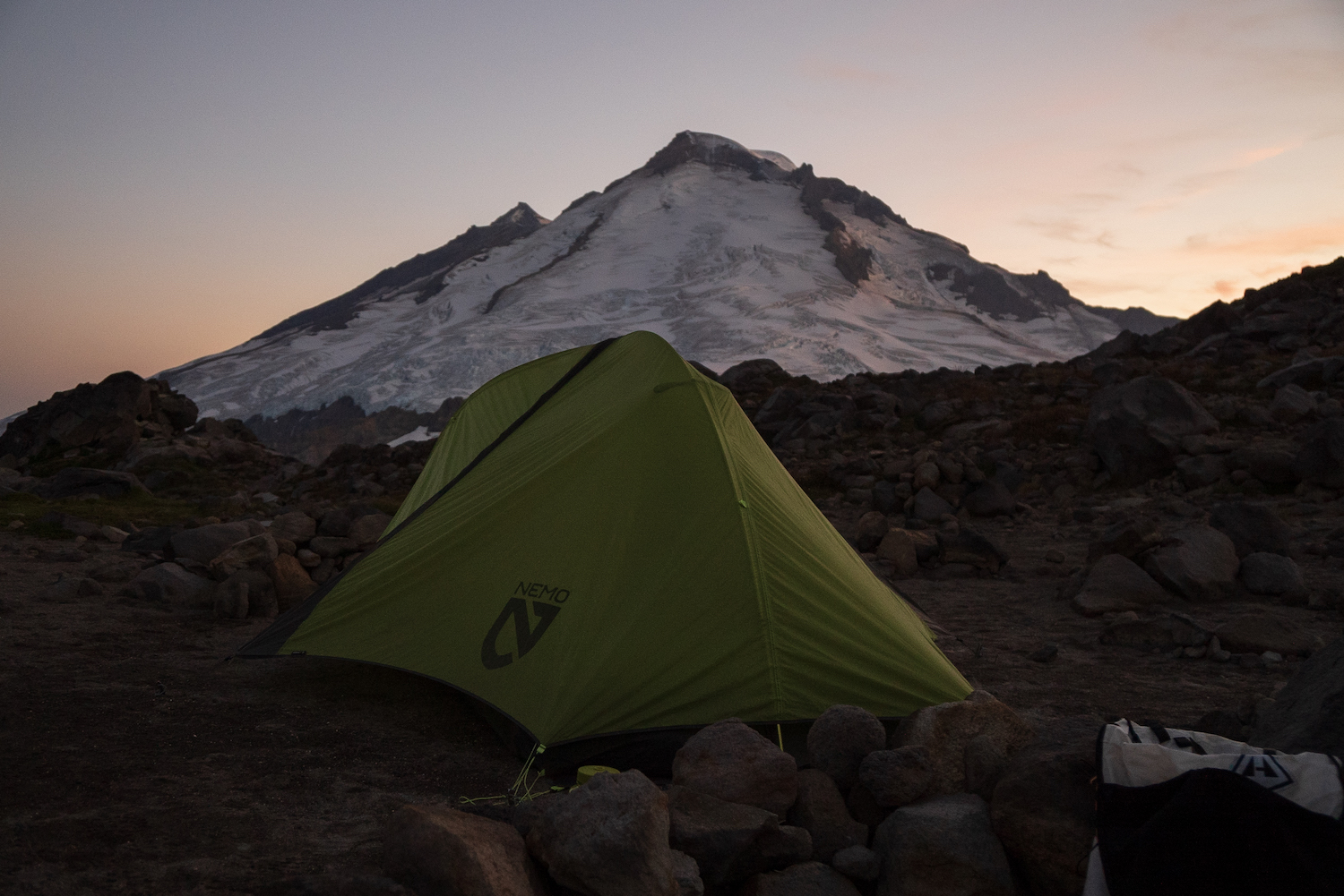
I chose to continue further up the trail and camp near the Portals, a prominent rock formation well known to climbers who summit Mount Baker from the northeast. The Portals essentially mark the end of Ptarmigan Ridge, which ends in a precipice with a sheer thousand-foot drop.
Immediately after Camp Kiser, there’s a steep grade up large rocky terrain. This is the last few hundred feet of elevation you must climb, skirting large boulders and tricky terrain. After making the push to the top, you’ll run into a few tent pads built up with rocks to create makeshift walls to protect from the wind. After a tiring haul up, your first thoughts might be to set up camp here, but I would continue further, dropping down in elevation slightly towards a snowfield.
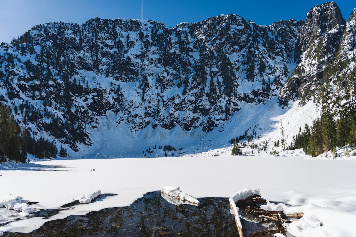
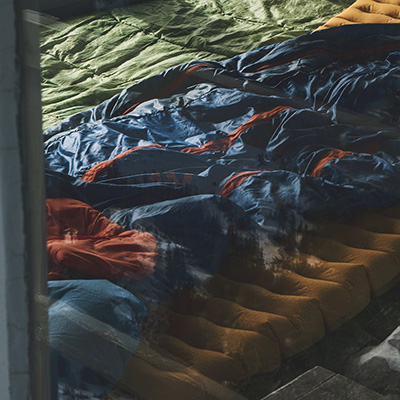
I found the best camping spots past this snowfield. The terrain was much more conducive for camping. The area was flat, slightly rocky but mostly sandy. It also was in close proximity to the large snowfield, which during July was the only water source available. It actually took me several minutes to fill up my bottles via the runoff. In cooler temps, you’d likely have to boil snow, so keep that in mind.
I can’t even begin to explain how beautiful it was up here. Out of all the places I’ve camped over the years, Ptarmigan Ridge ranks among the very top. The views of Mount Baker to the south and the North Cascades to the north were amazing. The glaciers on Mount Baker feel incredibly close. You can see all the crevasse fields, icefalls, seracs, and moraines on the volcano. Often, you’ll hear the ice activity on the mountain echoing off the steep rock walls, a truly incredible experience.
Considerations for Staying on Ptarmigan Ridge
Staying on Ptarmigan Ridge requires thorough preparation due to the challenging conditions of the exposed mountain terrain. Here are key considerations:
- Be Prepared for Weather Changes: The weather can shift suddenly, so be ready for anything.
- Expect Cooler Temperatures: Temperatures will be significantly lower than at the trailhead, particularly at night.
- Manage Sun Exposure: With limited shade available, protect yourself from the sun behind rocks or in your tent.
- Water is Essential: Ensure you can collect snowmelt or boil snow for drinking; otherwise, retreat to lower elevations for better water access.
- Access May Vary by Season: The trail might not be accessible until early to mid-summer due to snow conditions.
- Emergency Preparedness: Carry a Garmin inReach or similar device for emergencies, given the remote and rugged nature of the area.
The Ptarmigan Ridge trail in the Mount Baker Wilderness is the perfect permit-free backpacking experience to some of Washington’s most stunning landscapes. From majestic views of Mount Baker to serene alpine meadows, this trail has so much to offer.