Vesper Peak: The Most Epic North Cascades Hike You Can’t Miss!
Vesper Peak is one of the most awe-inspiring hikes in the North Cascades, renowned for its Instagram-worthy views and challenging terrain. This hike had been on my to-do list for a while, and when I finally tackled it, I was not disappointed—will I be back? 100% YES! But when’s the best time to go? Why might a backpacking trip be better than a day hike? Where are the best campsites along the trail? In this detailed guide, I’ll cover all that and more, so you’re fully prepared to conquer the challenging terrain and capture epic photos.
Backpacking or Day Hiking Vesper Peak?
This hike, with a total distance of 7.5 miles and an elevation gain of 4,127 feet, can be done as either a day hike or an overnight backpacking trip. The steep elevation makes it a tough day hike, and even more challenging with a full pack overnight—but at least you get to spread it over two days. I’d recommend the backpacking option to fully enjoy both the sunset and sunrise from Vesper Peak. It’s hard to catch those moments on a day hike without starting super early or finishing in the dark.
How Vesper Peak got its name?
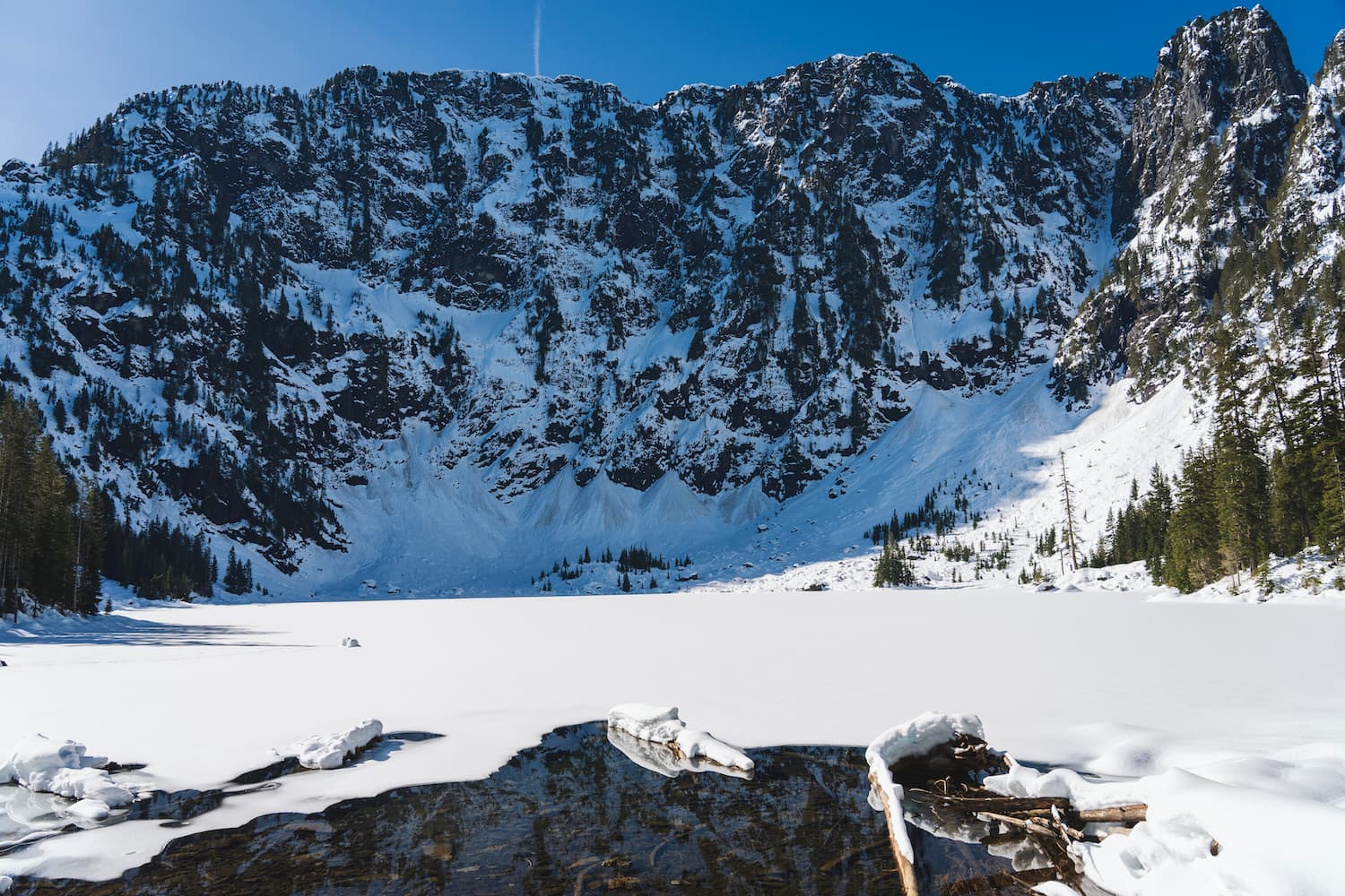
Vesper Peak, standing at 6,214 feet, is a prominent feature in Washington’s North Cascades. The granite summit is part of a rugged landscape shaped by glaciers, some of which still exist below the peak, carving out the terrain and feeding the streams and waterfalls. The name “Vesper” likely comes from the peaceful evening views the peak offers, akin to vespers, or evening prayers.
Instagram Famous?
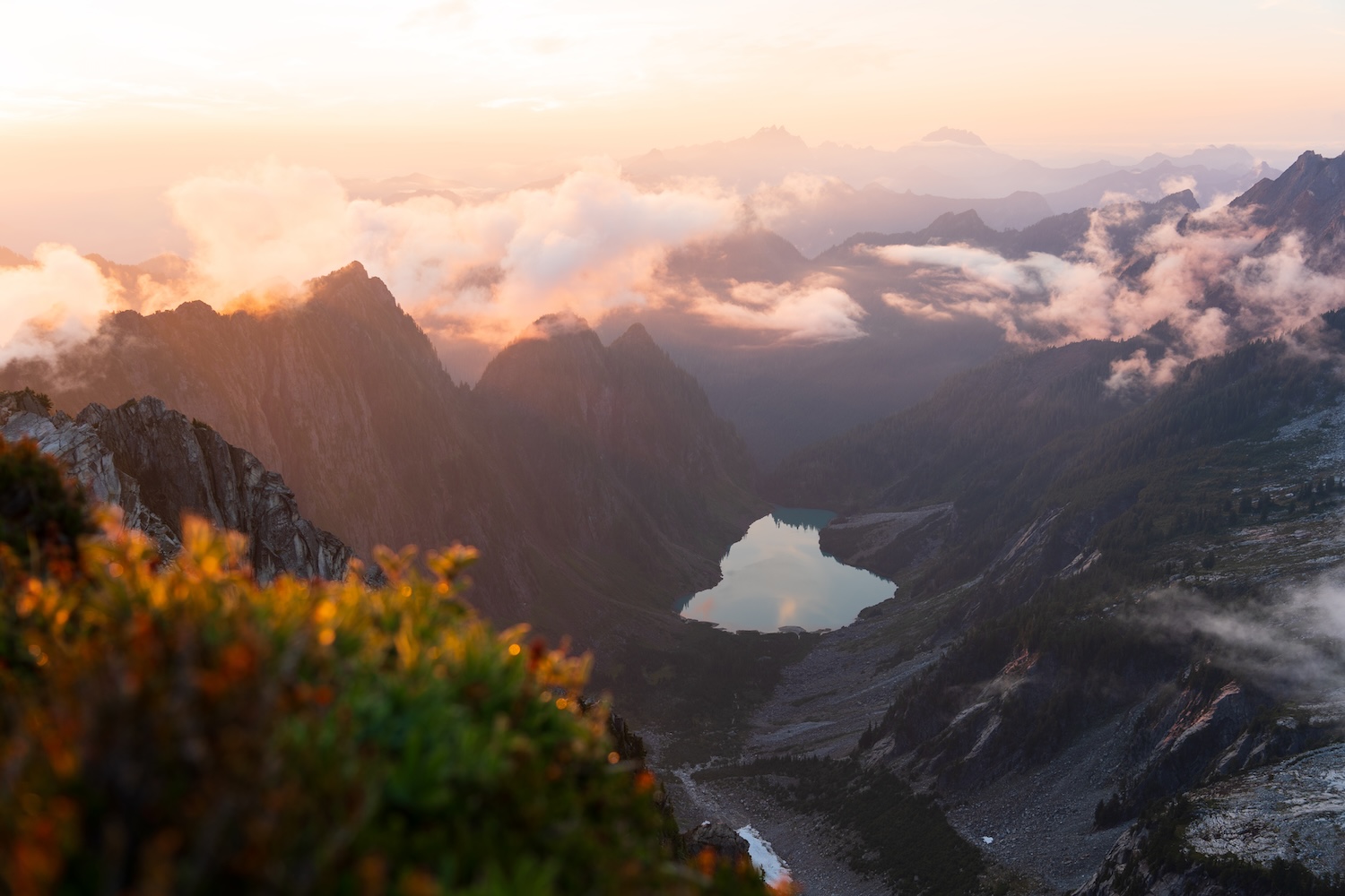
Vesper Peak has seen a significant increase in photographers, especially Instagrammers aiming to “recreate” popular shots they’ve seen online, thanks to its breathtaking views and dramatic landscapes. While it’s great that more people are experiencing the beauty of the area, it’s a touchy subject. The influx comes with the risk of trails being damaged by those unfamiliar with Leave No Trace principles. The early and late lighting creates stunning layers of mountains, offering incredible photo opportunities. For the best experience, and to avoid crowds, consider hiking on a weekday.
Getting to the Vesper Peak Trailhead
From the Mountain Loop Highway, it takes about 10-15 minutes to reach the Sunrise Mine Trailhead, which you’ll start from for the Vesper Peak hike. The road is a mix of rough patches and decent-sized potholes, so a high-clearance vehicle is recommended. There’s a small washout close to the trailhead so if you have a low clearance vehicle you’ll have to walk from here. Parking is roadside and limited, so arriving early is key, especially on weekends. The narrow road makes passing difficult, often requiring one car to reverse. A picnic table and outhouse are available, and don’t forget your Northwest Forest Pass, it’s required.
Do I Need Permits for Backpacking Vesper Peak?
No permits are needed for this North Cascades hike, but competition for prime camping spots can be fierce. I’ll dive into more details on the camping options ahead.
The Best Time to Hike Vesper Peak?
This hike is best done from July to September. The trail is often snow-covered until mid-summer, so plan accordingly. While the Mountain Loop Highway closes in sections during winter, the Vesper Peak trailhead remains accessible since it’s on the paved portion of the highway. However, be aware that the road can close unexpectedly in winter conditions, and nearby wildfires could also potentially shut down trailheads along the Mountain Loop. Always check current conditions before heading out to ensure the trailhead is open and accessible.
Overnight
41°F
Clear
Mon
58°F
Sunny
Mon Night
47°F
Clear
Overnight
41°F
Clear
Mon
58°F
Sunny
Mon Night
47°F
Clear
Tue
60°F
Sunny
Tue Night
51°F
Mostly Clear
Wed
60°F
Mostly Sunny
The Hike to Vesper Peak
From the trailhead, you’ll quickly cross a small stream and continue on a rocky trail through a lush, wet forest. At 0.4 miles, the trail begins to gain elevation, leading to another stream crossing before heading up a steep grade. Around 0.5 miles, you’ll reach the South Fork Stillaguamish River, where fording might be necessary depending on the season, though in summer, it’s usually not required. Shortly after, the trail opens into a meadow on your right, with the trail staying to the left.
You’ll switchback higher up through the meadows, and at 0.7 miles, cross another stream. The trail then crosses an avalanche chute or dry stream bed, continuing through the meadows as you gain elevation. This section is primarily gravel and dirt. Around 1.1 miles in, the trail re-enters the forest, where blueberry bushes begin to line the dirt and root-laden trail. At 1.25 miles, a boulder field offers a chance to spot pikas gathering wildflowers and calling to each other.
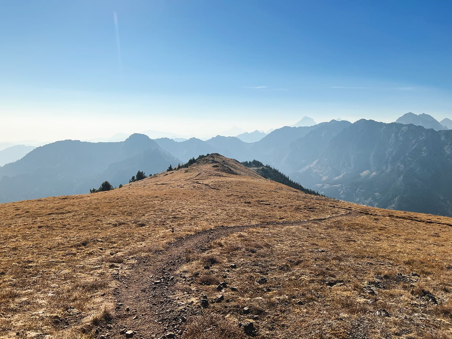
The trail climbs steeply to the ridge between Morning Star and Sperry Peaks over the next mile, opening into a large, rocky valley filled with pines and bushes. The elevation eases to a steady incline, with blueberries lining the trail. Rock climbers often camp here, tackling the walls on either side or venturing further into the mountains. As the valley narrows, the trail becomes steeper and more unstable with gravel and loose rock. At 1.8 miles, the trail emerges from the pines onto a rocky, boulder-filled slope, where you can hear small waterfalls cascading off the steep cliffs, with patches of snow lingering even in August.
Around 2.2 miles, the trail reaches a very steep section, but multiple switchbacks make the ascent a bit easier. By 2.4 miles, the rocky terrain transitions into ferns and grasses, resembling an alpine meadow. Here, you might hear more pika calls, signaling the abundance of vegetation. As you approach a steep cliff at around 2.5 miles, it may seem like the trail ends, but a hard right turn in the boulder section continues the trail. This area can be a bit confusing.
You should use caution just below Headlee Pass, as the steep, narrow, rocky chute is notorious for falling rocks. Wildflowers start appearing just below the steep grade up to the pass, with hummingbirds and bees being particularly abundant and active in this area. This section is the steepest yet, with nearly vertical gains despite the switchbacks. At 2.8 miles, you’ll reach the top of Headlee Pass.
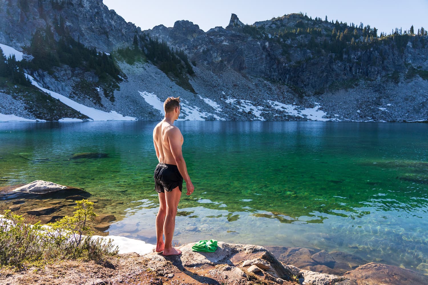
After reaching the top of Headlee Pass, you’ll descend slightly before climbing back up through another rock field. The trail then transitions into a forested area with small pine trees. Eventually, you’ll cross a stream that flows from Lake Elan. The lake is a short 5-minute side trip from the main trail, bringing the total mileage to 3.4 miles if you choose to visit.
From the stream, the next push higher leads you toward the summit of Vesper Peak. Initially, you’ll cross the stream, moving through dense heather and hardy shrubs. As you continue, the trail enters a thicket of short spruce trees, switchbacking up a rooty and dirt-covered path. Emerging from the trees, you’ll approach the final summit stretch across granite slabs and boulders. The trail becomes unclear here, so check your map to stay on track. Even in August, snowfields linger, feeding small water flows. Eventually, you’ll reach the summit for breathtaking views!
Camping Options Along the Trail to Vesper Peak
There are several camping options along the trail, some of which are well-established. I’ve included a map showing the locations of all the more established campsites. I recommend sticking to these sites to follow Leave No Trace principles and avoid creating new campsites.
Climbers Camp
Typically used by climbers, this area often has tents packed tightly together. As a backpacker, you might feel a bit out of place here.
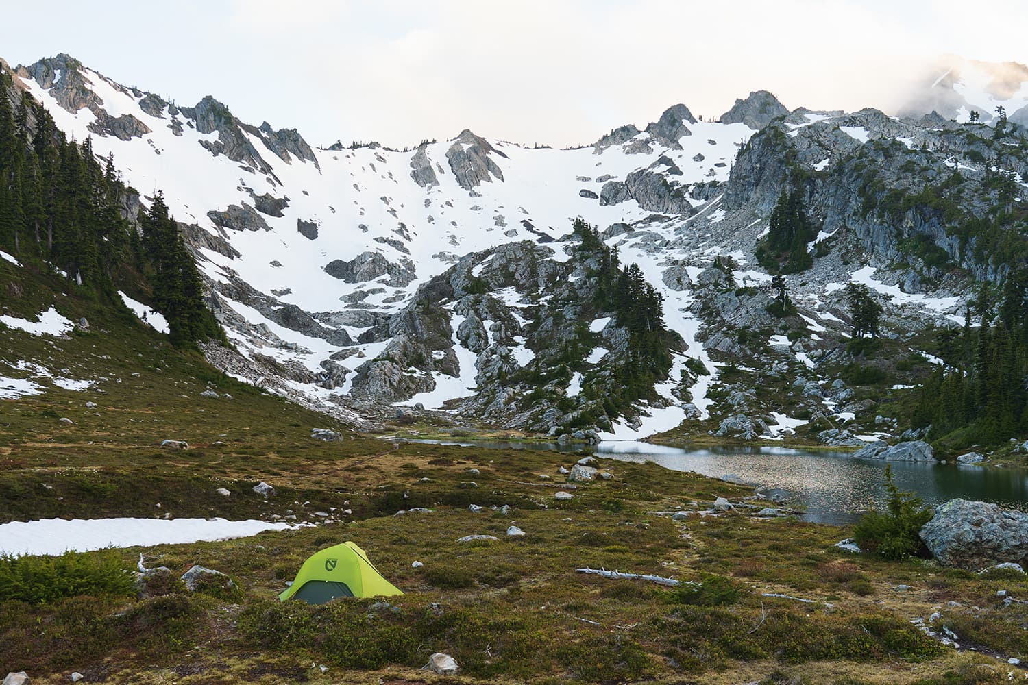
Lake Elan
Offers a few good campsites with flat ground, and the lake provides a convenient water source.
Vesper Creek High Camps
Five well-established campsites, some shaded by large pines and others in sunny grassy areas. The higher you go, the better the views, but you’ll be further from Vesper Creek, which is your closest water source.
Vesper Peak
The most sought-after campsite, with space for about three tents. It’s rocky, so finding a good spot can be challenging, and there’s no water source at the top. You’ll need to hike down about 10 minutes to reach snowmelt runoff if it’s still available in late summer.
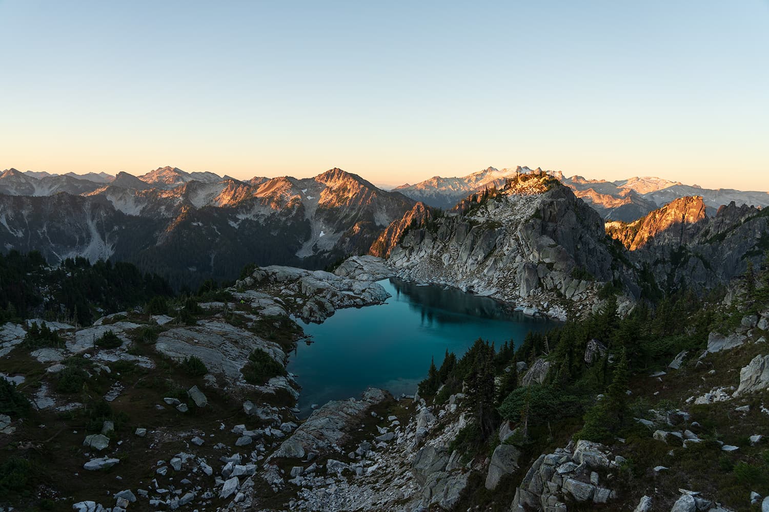
Unparalleled Photography at Vesper Peak
Similar hikes worth exploring.
Vesper Peak in the North Cascades is one of the best locations I’ve encountered for stunning photography. The mountain layers combined with the soft lighting at dawn and dusk create a breathtaking setting, perfect for capturing incredible shots.
Water Sources Along the Trail
- Stream crossing near the trailhead: Shortly after starting the hike, you cross a stream, which is the first water source.
- Small streams half mile in: These streams provide additional water early in the hike.
- Vesper Creek and Lake Elan: A reliable water source, easily accessible from the trail.
- Snowmelt runoff near the summit: Available around 4 miles, though it may dry up later in the summer, requiring a hike down from the summit to access Vesper Creek.
Abundant Wildlife on the trail
The trail to Vesper Peak is teeming with wildlife, particularly pikas, which I encountered in abundance. Their high-pitched calls echoed across the meadows as they busily gathered plants and wildflowers, a sight I’ve rarely seen in such numbers. At the summit, I also caught glimpses of marmots basking in the sun on the rocks. Though mountain goats are known to inhabit the area, I didn’t spot any during my hike, but the experience was still incredibly rich with wildlife activity.
Will I have Cell Service on the trail?
There is no cell service along 99% of the Vesper Peak trail. However, at the summit, I was able to receive and send a few texts and check the weather, but the signal was intermittent. I have Verizon. Don’t expect to rely on your cell phone for communication. Always download maps for offline use before your hike to ensure you have access to navigation tools even without a signal. I always have my Garmin inReach with me to communicate with friends and family and track my location.
Are Dogs Allowed on the Vesper Peak Trail?
Yes, dogs are allowed, but this trail is challenging and rocky. Take extra care to protect their paws, as they could easily get cut on the rough terrain.
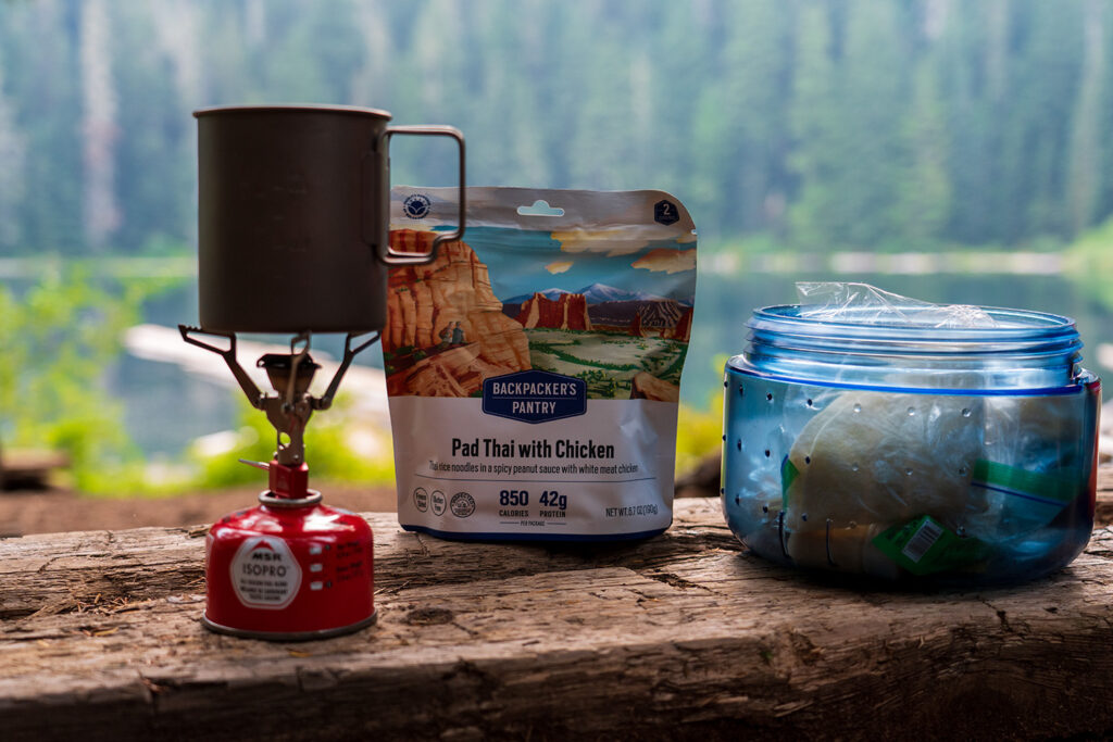
Tips for Hiking and Backpacking Vesper Peak
- If you are someone who doesn’t want to deal with crowds, do this hike during the weekday. You’ll also have better luck with getting decent camping spots – particularly the summit campsites.
- Make sure you have enough water to last you until Vesper Creek, after the first few water sources you’ll go without water for a while.
- Avoid camping on the summit if there are thunderstorms in the forecast. This is the last place you want to be with lighting present.
- Bring at least one trekking pole! I normally don’t use trekking poles but I found it to be really helpful with the difficult rocky terrain along the trail.
- Most of the trail is exposed to the sun so be sure to pack lots of sunscreen.
Vesper Peak is a MUST do hike!
Vesper Peak is a challenging but incredibly rewarding hike that showcases the best of the North Cascades. Whether you’re aiming to capture the perfect photo or simply want to immerse yourself in nature, this trail delivers. With its steep climbs, breathtaking views, and the chance to experience an amazing sunrise or sunset from the summit, it’s a hike worth doing. Just be sure to plan ahead, respect the trail, and take your time to fully enjoy everything this hike has to offer.