Upper Lena Lake Trail Guide (Olympic National Park)
Upper Lena Lake offers an exceptional day hike or overnight backpacking adventure. Accessible via paved forest roads, the trail treats hikers to stunning forest views that gradually open up to reveal alpine meadows and a tranquil lake cradled amidst majestic peaks. This hike, though moderately challenging, promises a rich reward of stunning views at Upper Leana Lake and even distance Mount Rainier views. In this guide, I’ll walk you through everything you need to know about hiking this trail and why it stands out as an ideal choice for both day hikers and overnight backpackers alike.
What is the best time to hike Upper Lena Lake?
The ideal time to hike to Upper Lena Lake would be from June to September. I hiked this trail mid-June and only experienced snow conditions at the lake. Other than having to ford a stream just before the lake, the trail should be mostly snow-free by June.
Today
60°F
Mostly Sunny
Tonight
51°F
Partly Cloudy
Mon
66°F
Partly Sunny
Today
60°F
Mostly Sunny
Tonight
51°F
Partly Cloudy
Mon
66°F
Partly Sunny
Mon Night
59°F
Partly Cloudy
Tue
71°F
Mostly Sunny
Tue Night
63°F
Partly Cloudy
Getting to the Lena Lake/Brothers Trailhead
Getting to the Upper Lena Lake trailhead is straightforward and accessible via a well-maintained paved forest road from the main Highway 101. However, watch out for occasional unmarked potholes that can catch you off guard if you’re not careful! Ample parking and pit toilets are available at the trailhead.
Required Passes for the Hike
You will need a Northwest Forest Pass or National Park Pass for parking. If you plan to stay overnight at Upper Lena Lake, you will need to obtain an Olympic Backcountry Wilderness Permit which I will get into more detail later in this post. If you plan to stay overnight at Lower Lena Lake you will not need a camping permit.
This Hike is Highly Customizable!
While most hikers opt for the scenic trek to Lower Lena Lake and back, venturing all the way up to Upper Lena Lake is an ambitious endeavor. Even if you choose to hike to Lower Lena Lake and return, it promises a rewarding experience. However, if you aim to reach Upper Lena Lake—a hike spanning 14 miles with a gain of 4,800 feet in elevation—be sure to allocate ample time for the hike!
The Trail to Lower Lena Lake
The trail begins with a steady ascent, gaining 500 feet in elevation over the first mile. It’s a challenging start but made manageable by a well-maintained trail and numerous switchbacks. Towering cedar and Douglas fir trees line the trail, with ferns adding to the lush scenery.
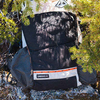
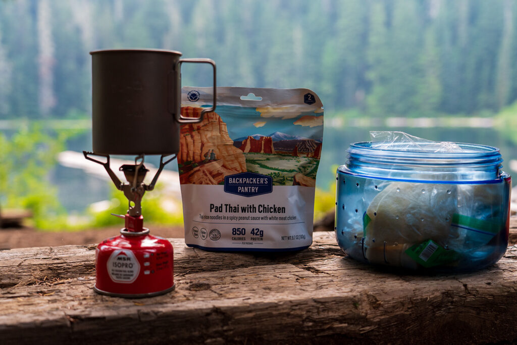
Kurt's Backpacking Gear
View My Full Gear List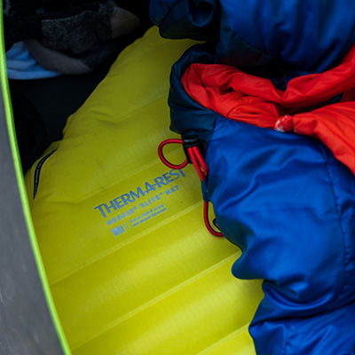

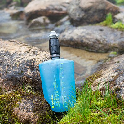
Continuing on, you’ll ascend another 250 feet over the next mile. Just before crossing a wooden bridge at the 2-mile mark, listen for a nearby stream to your left—a reliable spot to refill your water supply. This natural spring seems to emerge from under the ground right beside the trail.
Beyond the bridge, the trail climbs further with switchbacks before leveling out with a gentle incline. Watch for occasional muddy patches as you traverse the flat section. Small streams intersect the trail, offering opportunities to replenish water, though they may diminish in summer.
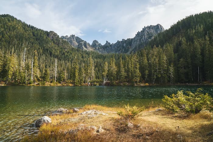
Before arriving at Lower Lena Lake, the trail splits; keep right to proceed towards the lake. The overlook at Lower Lena Lake makes for an ideal rest stop, surrounded by wildflowers cascading down the hillside with stunning views of the lake below.
The total distance to Lower Lena Lake is 3.4 miles.
The Trail Continuing to Upper Lena Lake
As you transition to the trail leading to Upper Lena Lake, you’ll notice it narrows significantly and becomes a bit overgrown in places. Fallen trees and signs of less travel are evident, contrasting with the more frequented Lower Lena Lake trail.
Throughout the hike, you’ll encounter several small streams crossing the trail. These are perfect opportunities to top off your water supply, always a smart move on any trail.
At 3.8 miles, you’ll reach a trail junction. Stay left to continue towards Upper Lena Lake; taking the right trail leads back down to Lower Lena Lake. Lena Creek flows alongside, guiding your way with a soothing sound of the creek in the distance.
Similar hikes worth exploring.
The elevation gain remains steady, without too many challenging switchbacks. The trail roughly follows Lena Creek to your right, offering pleasant views as you ascend.
At 4.5 miles, you’ll enter Olympic National Park, marking a transition to more pristine wilderness surroundings.
Around 5.1 miles, the forest opens up to reveal a magnificent view. Look uphill to spot a picturesque waterfall cascading down the mountainside, with Lena Creek flowing beside you, now smaller than its earlier form at the lake.
The trail briefly flattens out at 5.6 miles, where you’ll encounter a stream crossing. A log serves as a convenient bridge, and it’s another opportunity to refill your water.
Continuing onward, the trail gains elevation with a series of switchbacks, crisscrossing Lena Creek multiple times. Expect steeper terrain, prompting more breaks to catch your breath.
By 6.2 miles, expansive views of surrounding mountains unfold. Some peaks retain a dusting of snow in late June, while vibrant wildflowers begin to bloom in sun-exposed sections of the loose gravel trail. The air is sweet with the fragrance of birch and wildflowers.
At 6.4 miles, enjoy stunning panoramic views from atop a small cliff. The trail winds upwards with switchbacks, offering the best vantage point yet and showcasing the trail’s most exposed stretch.
Just under 6.8 miles, you’ll encounter a stream crossing requiring fording if water levels are high. You’ll want to remove your shoes for this one. The water is icy cold! Beyond, Alpine Meadows open up alongside a stream flowing to your left.
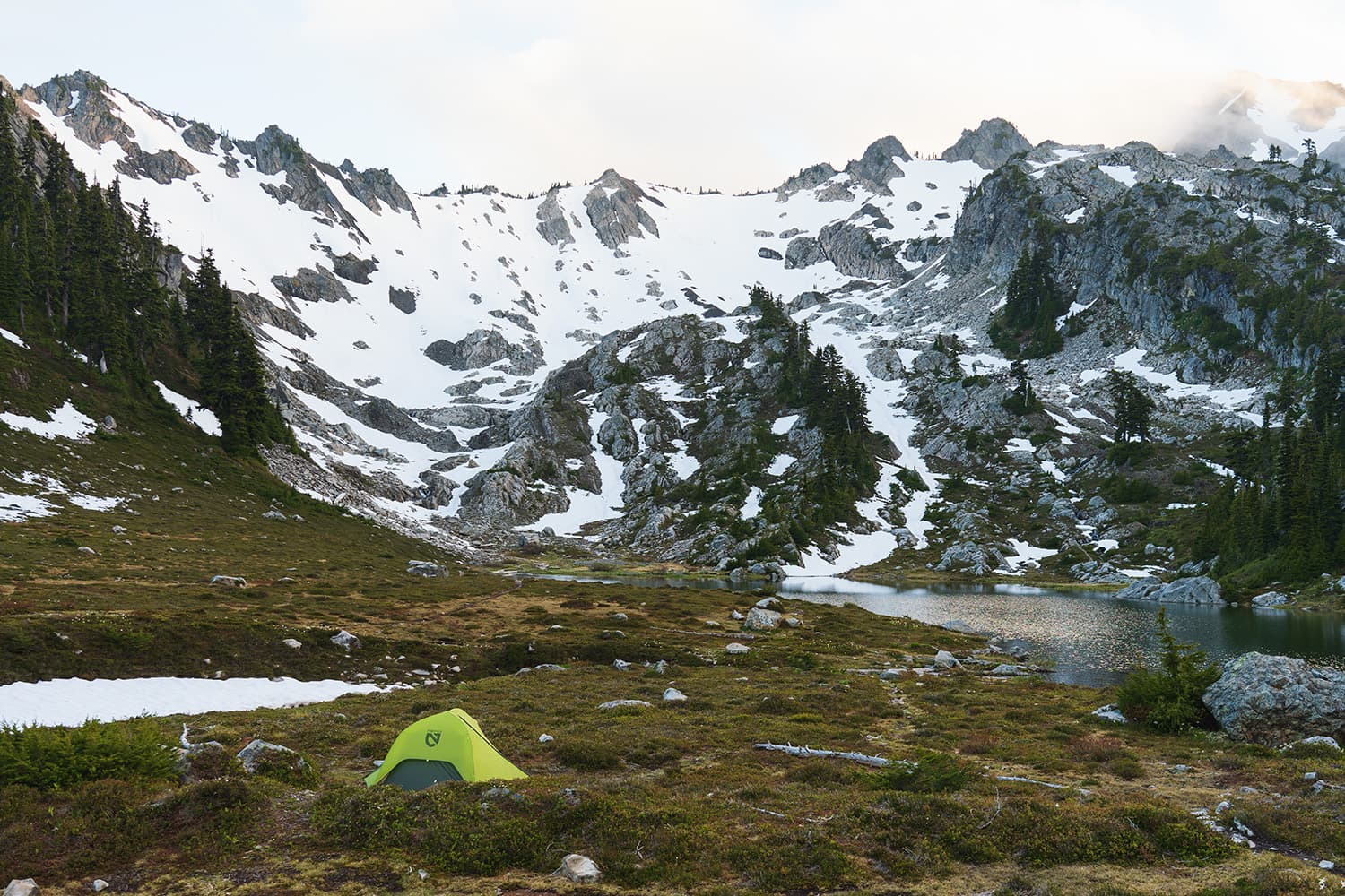
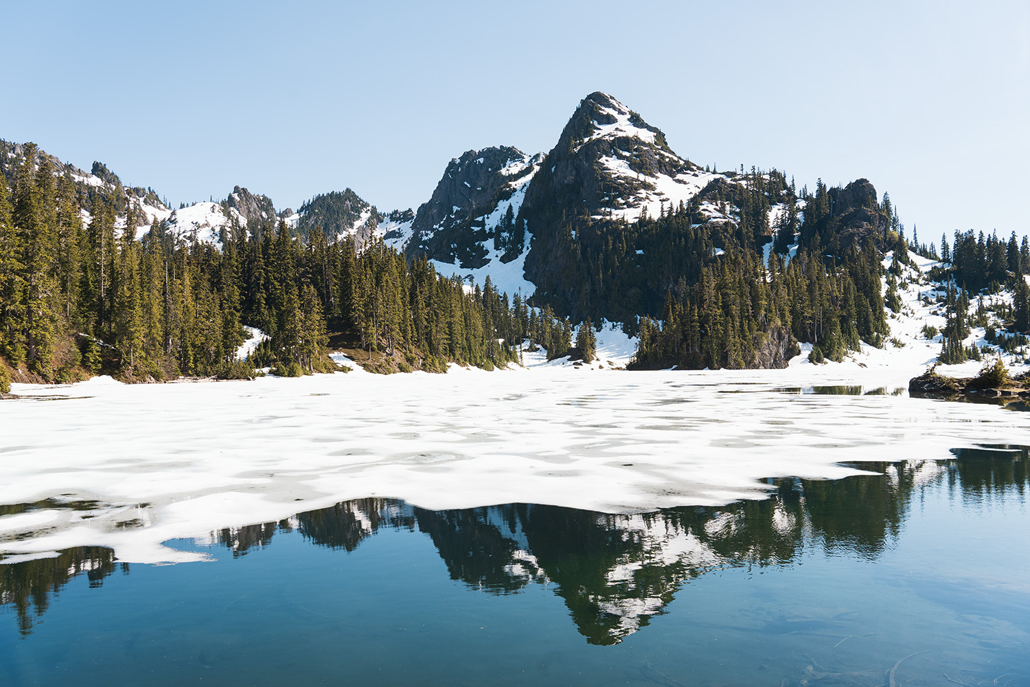
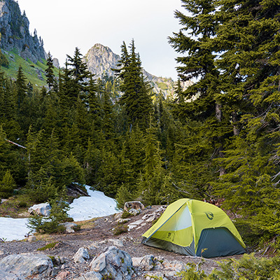
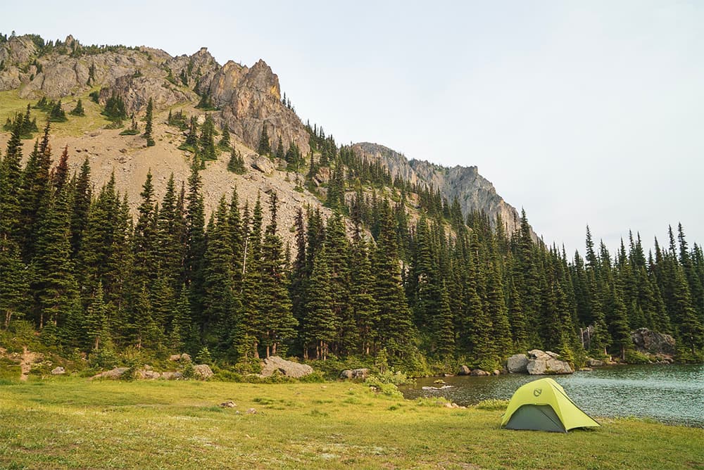
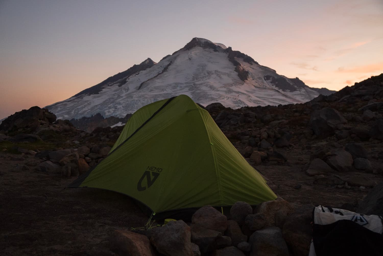
Approaching Upper Lena Lake, views of Mount Rainier may emerge in the distance. In late June the lake was still partially iced over but melting rapidly. Mount Bretherton dominates the landscape at Upper Lena. The total hike to the lake spans approximately 7 miles.
Camping at Upper Lena Lake
If you plan to camp at Upper Lena Lake, you will need to obtain a Wilderness Permit via Recreation.gov. You’ll want to select Staircase as the starting area, enter your start date, group size, and then select Upper Lena Lake.
Are dogs allowed on the trail?
Dogs are allowed on the trail until you reach the boundary for Olympic National Park which is about 4.5 miles in from the trailhead. Most people will just take their dogs to Lower Lena Lake. If you plan to head up to Upper Lena Lake, you should leave the dog at home.
Final Impressions: Upper Lena Lake
Consider this hike if you’re seeking accessible trails with breathtaking forest and alpine lake views. Upper Lena Lake in Olympic National Park offers both a challenging day hike and an excellent overnight backpacking experience. Permits are relatively easier to secure compared to other Olympic areas, making it ideal for spontaneous trips or last-minute adventures.