Hoh River Trail to Blue Glacier: The Ultimate Guide
How does a single trail transport you from the dense, green canopy of a temperate rainforest to the majestic, icy expanse of a mountain glacier? Enter the Hoh River Trail to Blue Glacier nestled within Olympic National Park. Spanning 40 miles with nearly 6,000 feet of elevation gain, this trail offers everything. In this comprehensive guide, I’ll unveil all you need to complete the Hoh River to Blue Glacier trail.
Overview of Hoh River to Blue Glacier
I recommend this trail for backpackers who are more advanced. Although the first half of this trail along the Hoh River is very easy, the remainder of the trail to Blue Glacier is strenuous. With the total mileage of the trail being just over 40 miles, you will have to spend at least a couple of nights in the backcountry, thus why I suggest you have some experience under your belt. It took me 2 nights and 3 days to complete this hike, but I was cruising. I think most would want to spend 3 nights and 4 days.
Best Time to Hike Hoh River to Blue Glacier
The Hoh Rainforest receives a ton of rain each year (almost 140 inches). After all, it is a rainforest! Most of the rain occurs late fall into early summer so ideally the best time to hike this trail is from late June to early October. By June, things should start to dry out and the snow in the upper elevations will start melting. I hiked the trail in mid-August and had zero issues with snow at higher elevations.
Getting Permits to Camp Along Hoh River Trail to Blue Glacier
Day Hikers aren’t required to carry permits along this trail, but if you plan to camp overnight, you will need to obtain a permit. You can get a permit by visiting the Olympic National Park Backcountry Permits on Recreation.gov. The starting area for this hike is Hoh. Then select the start date of your trip, how many people, and from there you’ll be able to select the campsites you want for each night. I will take a deep dive on what campsites you might want to select based on the various trip itineraries. I have photos of all the campsites which might help you pick the best option for you. Tip: Permit reservations for Hoh River Trail to Blue Glacier open up on April 15th at 7am PST.
Getting to the Hoh Rainforest Trailhead
Tonight
46°F
Mostly Clear
Sat
49°F
Light Rain
Sat Night
45°F
Light Rain
Tonight
46°F
Mostly Clear
Sat
49°F
Light Rain
Sat Night
45°F
Light Rain
Sun
49°F
Light Rain
Sun Night
44°F
Light Rain Likely
Mon
52°F
Chance Light Rain
The Trailhead for this hike is located at the Hoh Rainforest Visitor Center within Olympic National Park. The nearest town is Forks, Washington. This is a major trailhead within the park which can get very busy, especially during the summer. I have heard of hour wait times to enter. Plan your entry into the park to account for this. I arrived later in the afternoon and had no issues getting in. There is a dedicated backpacker parking area.
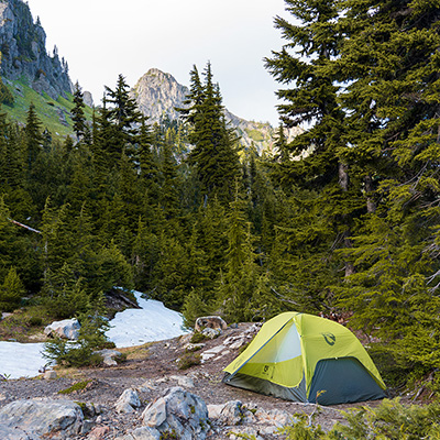
Camping Along the Hoh River Trail
The trail has numerous options as far as camping goes. Along the Hoh River Trail, there are several areas to camp before you begin the strenuous climb up towards Blue Glacier. These numerous river valley campsites enable you the ability to choose how far you want to travel the first day of your hike. You aren’t necessarily forced into putting in heavy miles. Below is a table of the available campsites to choose from when you book your reservation.
How to Choose a Campsite Along the Hoh River Trail
Itinerary Option #1 – Slow Pace (4 Nights /5 Days)
- Day 1: Camp at 5 Mile Island or Happy 4
- Day 2: Camp at Elk Lake or Martin Creek
- Day 3: Climb Blue Glacier. Camp another night at Martin Creek, Elk Lake or Glacier Meadows.
- Day 4: Camp at 5 Mile Island or Happy 4
- Day 5: Hike Out
Itinerary Option #2 – Moderate Pace (3 Nights/4 Days)
- Day 1: Camp at Olympus Guard Guard Station or Lewis Meadows
- Day 2: Camp at Martin Creek, Elk Lake, or Glacier Meadows
- Day 3: Climb Blue Glacier. Camp at 5 Mile Island or Happy 4
- Day 4: Hike Out
Itinerary Option #3 – Fast Pace (2 Nights/3 Days)
- Day 1: Camp at Olympus Guard Guard Station or Lewis Meadows
- Day 2: Climb Blue Glacier. Camp at Elk Lake or Martin Creek
- Day 3: Hike Out
Itinerary Option #4 – Avoid High Elevation Camping
Similar hikes worth exploring.
- Something to consider is totally bypassing camping at Martin Creek, Elk Lake, or Glacier Meadows.
- You could easily hike up with a day pack from Olympus Guard Guard Station or Lewis Meadows. It would be a pretty long day BUT you won't have the weight of your full pack.
I originally had chosen Option #2 – first night at Lewis Meadows, second night at Elk Lake, and third night at 5 Mile Island. However, I had a really good pace and arrived at 5 Mile Island early in the afternoon so finished my trip a day early, skipping 5 Mile Island. I am glad I decided to do this because the wildfire smoke from Canada blew in later that day. For most backpackers, this itinerary would push you pretty hard. I think 3 nights/4 days is the best way to do the Hoh River Trail to Blue Glacier.
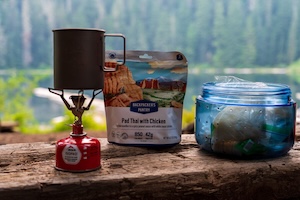
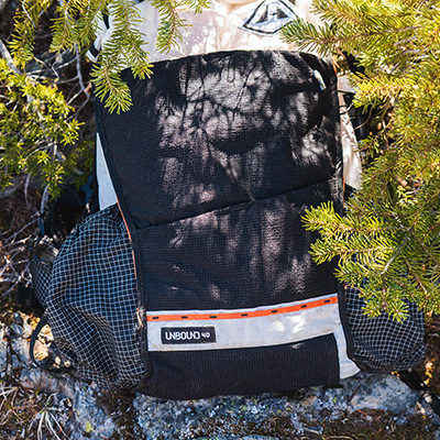
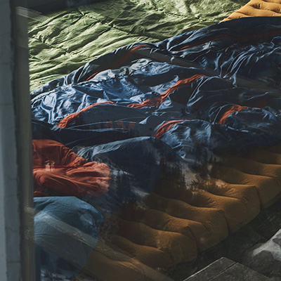
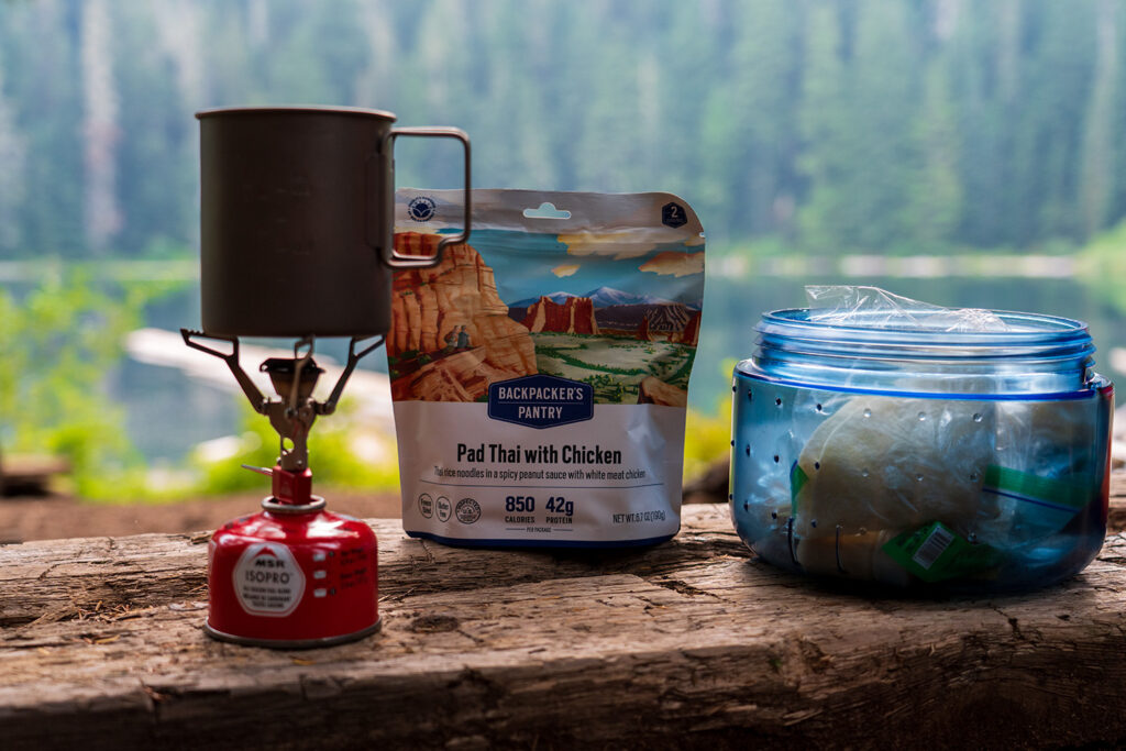
Kurt's Backpacking Gear
View My Full Gear List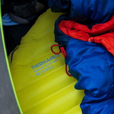
Day 1: Hoh River Trailhead to Lewis Meadows
I started my hike early in the evening just a bit after 6pm. My destination for the night was Lewis Meadows, 10.5 miles from the trailhead. I had a lot of ground to cover so had to maintain a pretty good pace to get there at a reasonable time. The trail starts right near the Hall of Mosses trail, which is another hugely popular trail in Olympic National Park for its towering evergreen giants and moss-draped maples. That trail is always crowded thanks to its Instagram fame. The Hoh River Trail runs through the same ecosystem so you will see all of that with significantly fewer people. Most of the day wanderers will walk about a mile or two in before turning around so beyond the 2-mile mark expect to see significantly fewer people.
The Hoh River Trail climbs 500 feet in elevation over the next 10.5 miles to Lewis Meadows. I barely noticed the elevation gain. There are a few sections where you drop down and then back up but that’s it. You can set a strong pace along this section. My GPS track showed I was averaging about 3.4 miles/hour over the 10.5 miles to Lewis Meadows. That’s quick with a full backpack.
The trail makes its way through temperate rainforest while following the Hoh River. You’ll catch glimpses of the glacier-fed river every now and then while on the trail. Massive 100-year-old Sitka Spruce, Douglas fir, Western Hemlock, and Cedars tower above you. Bigleaf Maples stretch far and wide, draped in feet of dangling moss. Ferns blanket the forest floor while new trees emerge from fallen nurse logs. There were times I felt overwhelmed and just needed to stop and take it all in. It felt like I was in some fairy-tail setting. Everyone should experience a lush forest like this.
I eventually passed 5 Mile Island campsite. The forest floor started to grow dark while the last rays of light retreated up the mountain slopes, casting the pines in a golden glow. With another 5 miles to still go and darkness setting in I picked up my pace.
The days leading up to my trip were hot and water levels swelled significantly along the river. 8 miles in I faced my first major stream crossing. I had read about stream crossings along the Hoh River Trail but from what I saw they looked fairly easy. This wasn’t the case. I was very surprised how deep and quickly the water was moving. It was on the verge of dangerous! Add in the fact I had to ford this in the dark…
I removed my trail runners and threw on my sandals, found a large stick to use as support, and followed the stream’s shoreline to find an appropriate location to cross. After about 10 minutes of trying to find the safest location to cross, I eventually decided to wade in and make my way to a large fallen tree which would take me above a deep section of the stream. Further down the trail (0.3 miles), there was another stream crossing! Again, it took me some time to find a safe way to cross. I waded the whole way this time up to my knees in icy cold fast-moving water.
Shortly after the stream crossings, you will arrive at Olympus Guard Station, another camping area along the Hoh River Trail. This area has a mix of grassy, wooded, and gravel bar camping. I passed a group of hikers along the trail in the dark without headlights just beyond Olympus Guard Station, so I assisted them back to their campsite. Please don’t put yourself at risk like this!
I eventually arrived at Lewis Meadows just past 9:00pm, tired from the fast pace I kept. I set up my tent in the darkness and refilled water down by the Hoh River. I finally capped off the night with a Subway sandwich I had been carrying the entire time. It hit the spot.
Day 2: Lewis Meadows to Blue Glacier to Elk Lake
I was up early the next morning because I had a big day ahead of me. My plan was to continue up the trail to Elk Lake, where I would set up camp and then complete Blue Glacier and head back down to Elk Lake. The day’s mileage would put me around 15 miles and 4,000 feet of elevation gain.
Zipping open my tent, I was greeted by a deer making its way through the meadows. From all the campsites I saw along the trail, I thought Lewis Meadows was the nicest. You cannot go wrong camping in the meadows or along the gravel bar. When I come back to do this trail, I would definitely choose to stay here for the night.
As you leave Lewis Meadows and get back on the main trail, you’ll notice the environment around you change. The elevation will start to gain faster. The trees start to change and you’ll notice more Western Hemlock and Douglas fir while seeing less Western Cedars, Sitka Spruce, and Big Leaf Maples. Further up the trail, you’ll notice a campsite to your right with a wooden post and a smaller marker with “12.4” (aka 12.4 miles) on it. This is actually another campsite with enough room for two tents that butts up against the Hoh River. I found that this campsite essentially splits the trail into two sections: The Hoh River Trail and the climb to Blue Glacier. Beyond 12.4 is the toughest section of the trail and if you were to do this early or late in the season, expect conditions beyond here to be significantly different than the valley.
Beyond 12.4 you’ll come to High Hoh Bridge which spans across the gorge with the Hoh River 100+ feet directly below you. From here you can catch a glimpse of the Bailey Range and also see Glacier Creek flowing into the Hoh River. Immediately past the bridge is 13.2 and 13.3 campsites. These campsites, along with 12.4, are non-reservable campsites and first come, first serve.
The elevation gain gets much steeper after you cross High Hoh Bridge. You’ll climb 1,300 feet over the next two miles. I lost the warming sun while climbing this section up to Elk Lake. These mountains are so large they will completely block out any sunlight. Switchbacks become your best friend. Without them, the elevation gain would be pretty brutal, but they provided some reprieve from the relentless gain in elevation.
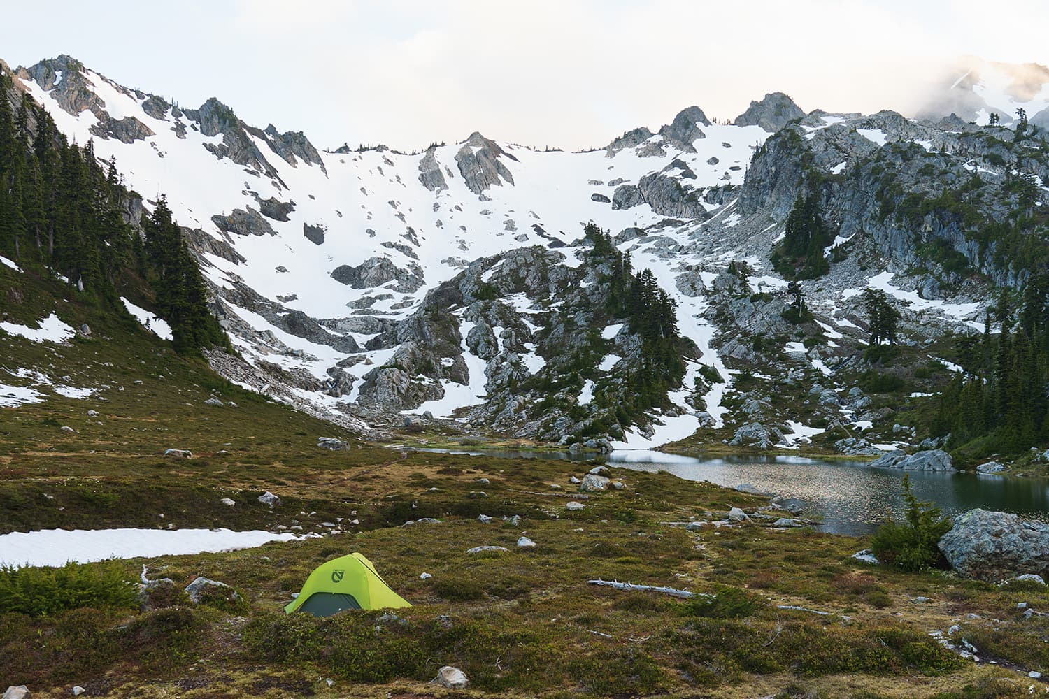
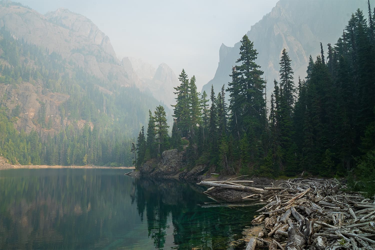
Martin Creek and Elk Lake come up pretty quickly. The roaring creek can be heard before it comes into sight. There are some really amazing views looking up the creek toward Stephan Peak. There are a few wooded campsites next to the creek. A word of caution – I stumbled upon a bee nest inside a fallen log. Be careful exploring off trail and always be aware of your surroundings. Elk Lake is just a short 10 minutes up the trail from Martin Creek.
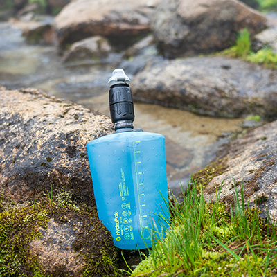
I set up camp at Elk Lake around noonish. Threw back some food, hydrated, and took about 30 minutes to rest. The campsites are located up the hillside from the lake under some big pines. I would strongly suggest using Martin Creek as your main water source when camping at Elk Lake. I found the water at Elk Lake to be muddy. I opted for the 10 min walk to Martin Creek to refill. Bears can be common at Elk Lake, as per a conversation I had with a ranger on the trail.
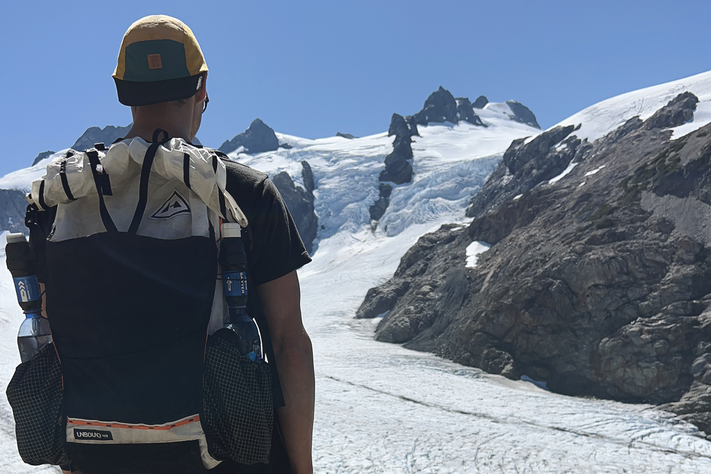
Climbing to Blue Glacier
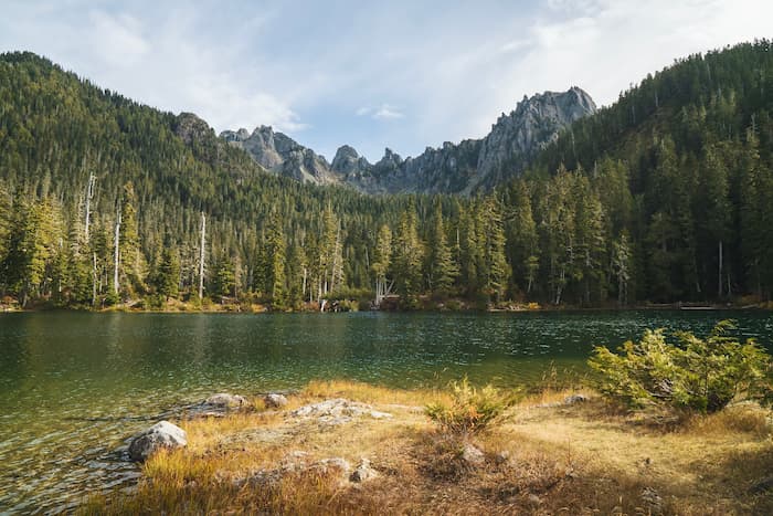
From Elk Lake, there’s another 2,600 feet of elevation gain over the next 2 miles, so it’s a pretty strenuous hike to the terminal moraine of Blue Glacier. The trail quickly climbs above Elk Lake and Bogachiel Peak can be seen in the distance. Just beyond this area is the 7 Lakes High Divide – another amazing area to backpack in Olympic National Park.
The trail opens up from dense forest to a rocky ravine with a small creek running through it. Wildflowers dot the edges of this creek. Head back into the forest through a tall stand of widely spaced silver firs. Eventually, the views of Olympus appear and the sound of Glacier Creek can be heard miles away roaring through the valley.
The trail cuts through an extremely steep slope, narrowing to shoulder width, dropping hundreds of feet to your right side. Traversing this slope with any snow could be extremely dangerous, something to keep in mind if you plan to do this trail in the early spring or fall.
One of the highlights of this hike is the Jemrod Gully Ladder. The trail opens up to an ever-eroding sandy slope with views of Mount Olympus. A 100-foot cable and wood rung ladder are there to help you down. It was in fairly good condition besides a few missing rungs. It honestly looks more intimidating than it is. I had fun going down it and did not find it difficult at all.
After you drop down, Jemrod Creek is to your right. I would absolutely take the time to hydrate here and then top off all your water before continuing. I was able to find water further up towards Blue Glacier, but Glacier Meadows did not have a readily accessible water source. Glacier Meadows comes up quickly after dropping down the Jemrod Ladder. This camping area is shaded with lots of pines.
Beyond Glacier Meadows campsites, the trail splits off in two directions. I stayed left, which takes you up to Blue Glacier Lateral Moraine. If you go right, it will take you to the bottom of Blue Glacier. The views from the lateral moraine are better. The trail opens up to lush meadows and wildflowers.
The meadows eventually give way to rocky terrain as you get closer to the lateral moraine. I passed a small pool of water (likely remnants of snowmelt) before the final ascent, which was a good stopping point to refill water and have a bite to eat. I met some other hikers here whom I helped top off water for because they had forgotten their filter back at camp.
Blue Glacier on Mount Olympus
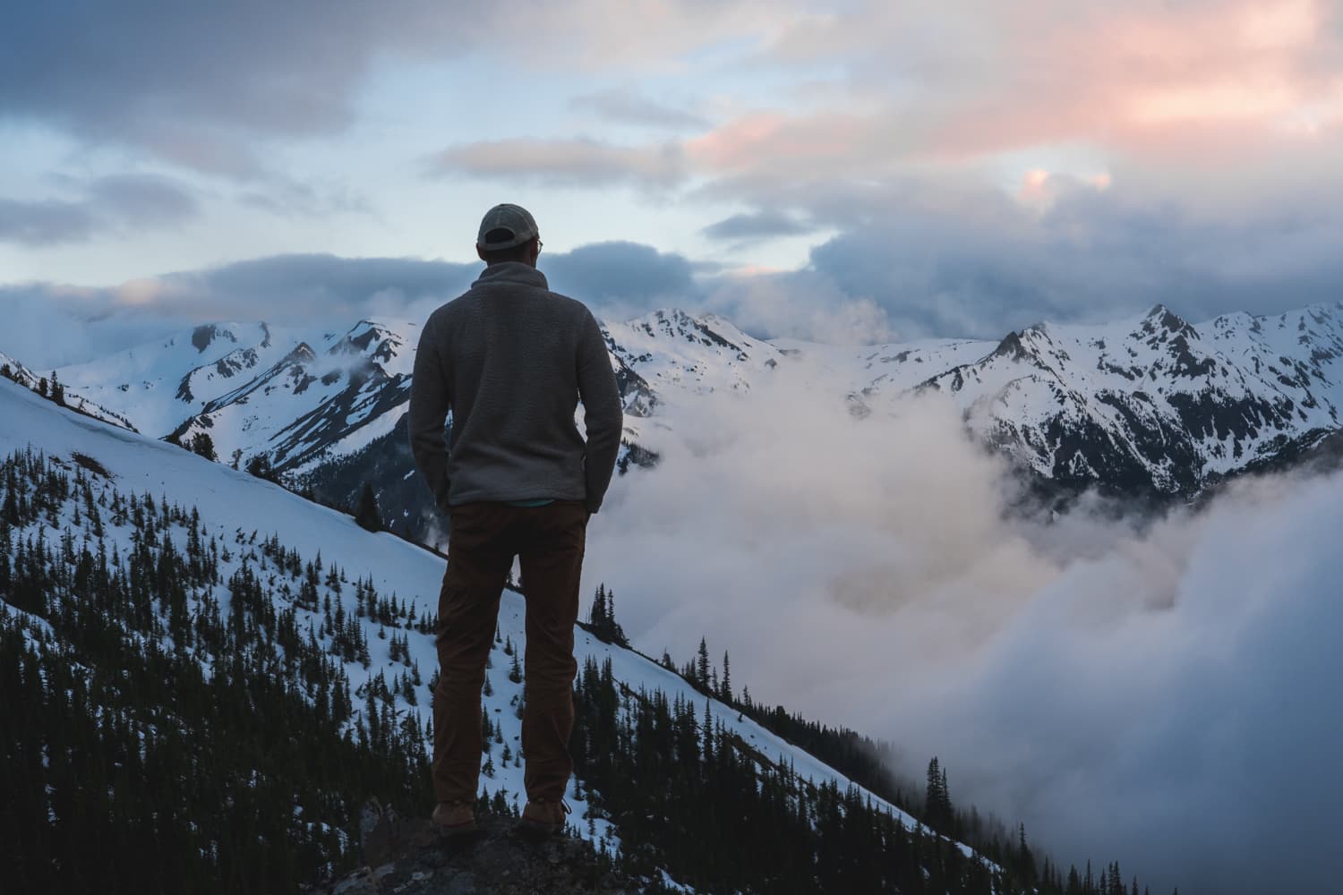
As you crest the lateral moraine, the views of Blue Glacier hit you in spectacular fashion. The glacier sweeps down the rugged slopes of Mount Olympus. The crevasses of the glacier can be seen clearly. If you listen closely, you will be able to hear the shifting ice within the glacier and often spot tumbling rocks and ice from the steep slopes of Mount Olympus. I spent over an hour here watching and listening to the mountain before heading back to camp at Elk Lake.
Tips for Hiking the Hoh River Trail to Blue Glacier
Overall, I highly recommend backpacking the Hoh River to Blue Glacier if you’re looking to immerse yourself in the diverse landscapes of the Pacific Northwest. This trail offers a unique journey through the lush, moss-draped canopies of a temperate rainforest, across alpine meadows brimming with wildflowers, and culminates at the awe-inspiring expanse of a glacier—a combination you won’t find just anywhere. The variety of camping options along the way enables you to tailor your adventure to suit your preferences and pace. When you reach the final ascent to the lateral moraine of Blue Glacier, the breathtaking view makes every step of the journey profoundly rewarding.