Bertha May and Granite Lakes: Easy Alpine Lake Hike Near Mount Rainier
If you’ve ever visited Mount Rainier National Park on a weekend, you know how crowded it can get—especially with the new timed entry system. This system requires a reservation to enter the park between 7 a.m. and 3 p.m., unless you arrive before 7 a.m. or after 3 p.m., which can be a hassle.
Luckily, the Bertha May and Granite Lakes hike provides a perfect alternative. Located just outside the national park, this easy trail offers stunning alpine lake views and, on clear days, a glimpse of Mount Rainier itself. Whether you're looking for a scenic day hike or an overnight backpacking destination, Bertha May and Granite Lakes have you covered—without the need to navigate timed entry restrictions.
Best Time to Hike Bertha May & Granite Lakes
This hike is best from late spring to early fall, as snow limits access in winter. If you plan to hike outside this peak window, check recent trip reports for nearby High Rock Lookout, which has a similar elevation. AllTrails or WTA reports can help determine if the trailhead is accessible.
Today
57°F
Mostly Sunny
Tonight
47°F
Mostly Cloudy
Wed
61°F
Sunny
Today
57°F
Mostly Sunny
Tonight
47°F
Mostly Cloudy
Wed
61°F
Sunny
Wed Night
44°F
Mostly Clear
Thu
61°F
Mostly Sunny
Thu Night
46°F
Mostly Clear
Which Route to Choose?
There are two different routes to Bertha May and Granite Lakes, each accessed from separate trailheads with significantly different mileage and elevation gain. It’s important to choose the right trailhead based on your desired difficulty level. The more challenging route starts at the Big Creek Trailhead, stretching 10 miles with over 2,700 feet of elevation gain. The easier route, which I’ll be covering in this post, is 3.7 miles with a moderate 732 feet of elevation gain. If you’re looking for the easier option, you’ll want to begin your hike at the Teeley Creek Trailhead.
Getting to Bertha May & Granite Lakes (Teeley Creek Trailhead)
From Ashford, WA, take Highway 706 and turn right onto NF-52. After 4.7 miles, turn right onto NF-84, a gravel road. Continue for 1.5 miles, then turn right onto NF-8410 and follow for 3.8 miles to the trailhead on your left. A high-clearance vehicle is recommended, but a sedan can make it with caution. Note: There are no bathroom facilities at the trailhead.
The Trail to Bertha May & Granite Lakes
The trail can easily be broken down into three sections, Trailhead to Pothole Lake, Pothole Lake to Bertha May Lake, Bertha May Lake to Granite Lake.
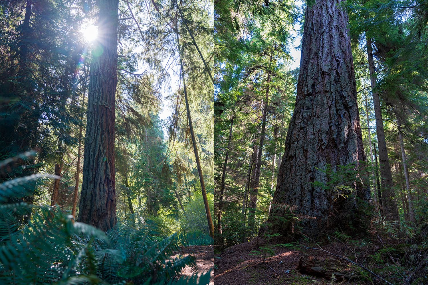
As soon as you begin the hike, the trail opens up to a clearcut area with beautiful views of distant peaks—where you’ll eventually be heading. It gives you a good sense of the elevation gain ahead, though it’s not too steep! To your left, you’ll see new forest growth, while to your right, towering Douglas firs fill the old-growth forest. After rounding the first bend, you’ll be greeted with views of Mount Rainier on a clear day. Unfortunately, during my hike, wildfire smoke and higher temperatures obscured the view, allowing only faint glimpses of the mountain’s features.
You’ll quickly reach Pothole Lake after a short half-mile. I paused for a quick look—it’s a neat spot, but it doesn’t quite compare to the two lakes still ahead. Continue along the trail, passing a broken-down wooden bridge (don’t worry, it’s still passable) and begin gaining elevation as you skirt around the backside of Pothole Lake. The trail then crosses a rocky section lined with Devil’s Club, where a small stream flows down from Bertha May Lake above.
As you continue to gain elevation, the trail becomes steeper and more pronounced after crossing the stream. Ferns line the path while old-growth pines tower overhead. You’ll make your way through several switchbacks. At one of the turns, a less-defined trail branches off to the right, but be sure to stay left and follow the main, more defined trail. From here, it’s only about 10 minutes to the lake. The steepest section comes just before you reach the lake.
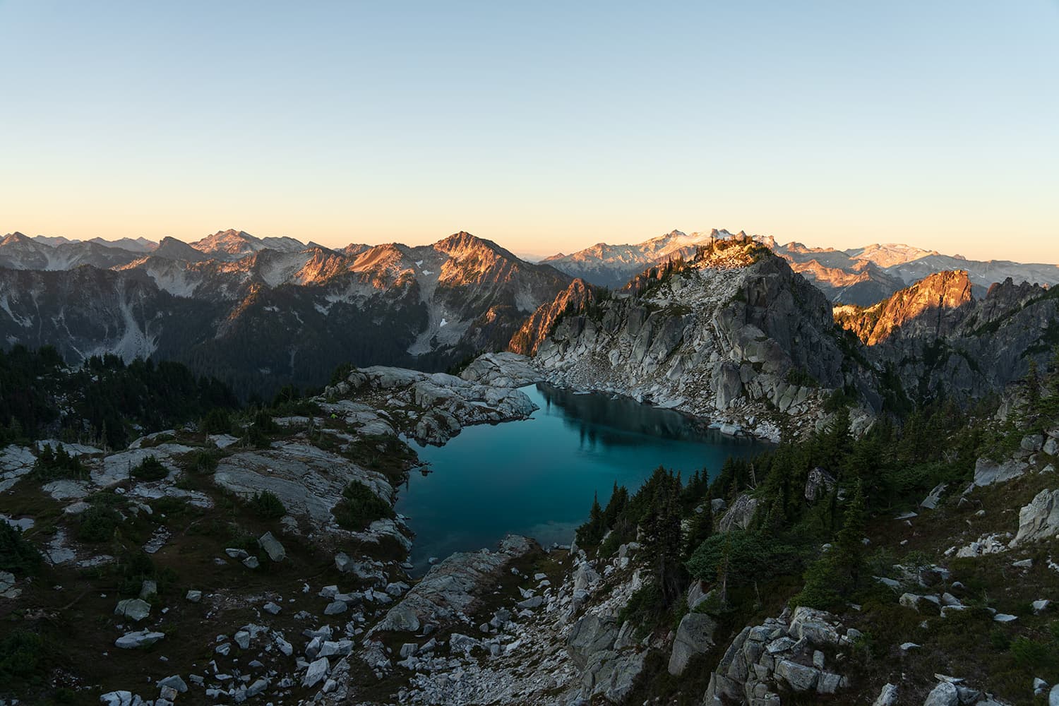
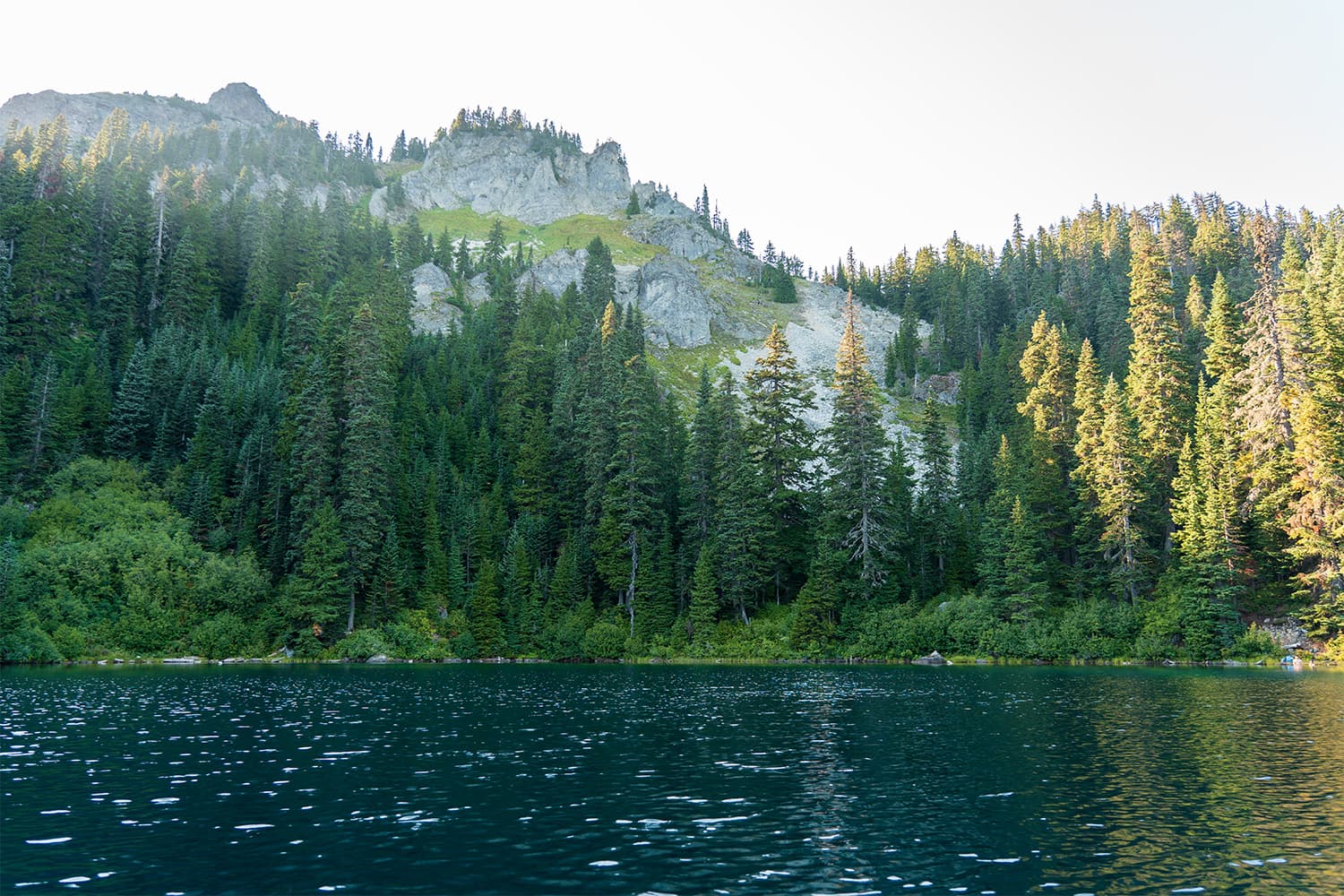
As you reach the lake, you’re immediately struck by the granite peaks towering over 5,000 feet, rising a full 1,000 feet above the water. The sunlight enhances the lake’s stunning blue-green hues, reflecting the pines that line the mountainside. Large floating logs drift slowly across the surface with the breeze. There are plenty of campsites around, making it an ideal spot to relax, enjoy lunch, and take in the breathtaking views. You could choose to end your hike here, but if you’re up for more adventure, consider continuing on to Granite Lake for even more stunning views. Here’s why you should keep going…
From Bertha May Lake, it’s just a short half-mile walk to Granite Lake, which takes less than 15 minutes. On a clear day, you’ll catch impressive glimpses of Mount Rainier through the trees near the lake. If you’re looking to take a refreshing dip in an alpine lake, Granite Lake is the best spot along this route. Its sandy shoreline provides an ideal wading and swimming area. Just like Bertha May Lake, the granite peaks towering over 1,000 feet above create a dramatic backdrop for your swim. You’ll also find several campsites located halfway along Granite Lake’s shoreline, making it a perfect spot to extend your stay.
Campsite Options at Bertha May & Granite Lake
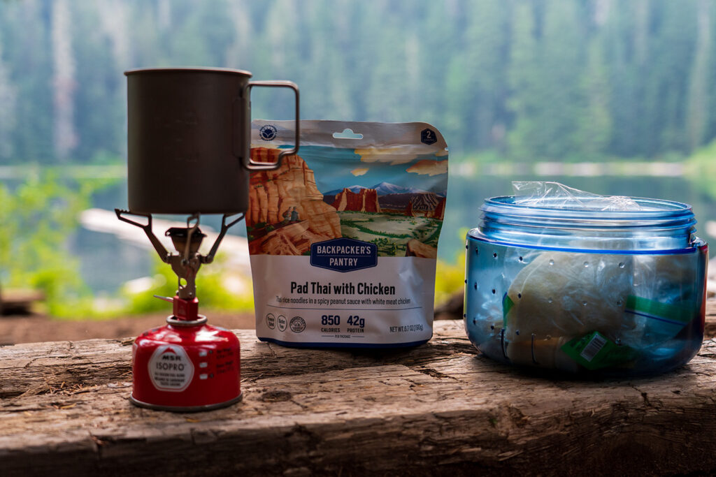
There are plenty of camping options at both Bertha May and Granite Lakes, and the best part is that no permits are required—camping is first come, first served. After exploring both lakes, I found that camping at Bertha May was the better choice. Personally, I preferred the campsite options at Bertha May Lake for their superior lake views.
Bertha May Lake Campsites
The campsites at Bertha May Lake are all clustered where the trail first meets the lake. There are around five reasonably flat spots near a central fire ring with log seating, and you could squeeze in a few more tents in less flat areas. There are also plenty of good hammock spots. With no pit toilet, be sure to bring a shovel to dig a 6-inch cat hole at least 200 feet from camp. There’s a small stream where you can collect drinking water, but I found that venturing out onto the floating logs to gather water directly from the lake worked better. Be sure to filter the water before drinking.
Granite Lake Campsites
Similar hikes worth exploring.
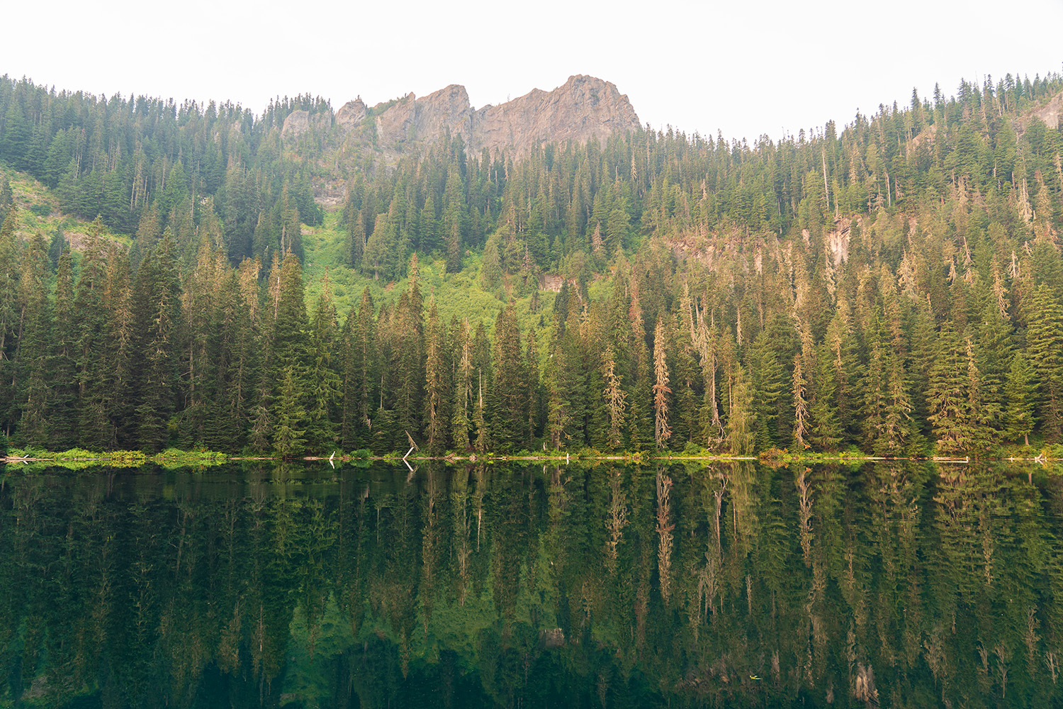
The majority of the campsites are located midway along Granite Lake’s shoreline. Unlike the sites at Bertha May Lake, these are set slightly back from the shore, with most offering partial lake views, though some have none. I counted about four good, flat tent spots, with a few less level areas available as well. The campsites here are more spread out and not clustered together. A stream flowing from Granite Lake provides a good source for filtering drinking water, and there are no pit toilets at this location either. Additionally, there are excellent views of Mount Rainier just a minute up the trail.
Fishing at Bertha May & Granite Lakes
Yes, you can fish at both Bertha May and Granite Lakes, which are home to Cutthroat and Rainbow Trout. Granite Lake also has naturally reproducing Eastern Brook Trout. Since Granite Lake has clearer water, fishing can be more challenging here compared to Bertha May Lake, which has a darker green hue that may make it easier to catch fish.
Is Bertha May & Granite Lakes Family Friendly?
Yes, this trail is very family-friendly! I saw several families with young kids enjoying the hike. It’s a great option for a day hike, thanks to the shorter mileage and manageable elevation gain, making it ideal for families.
Are dogs allowed on the trail?
Yes, dogs are allowed on this trail as long as they are leashed.
Why you should consider the hike up to Bertha May & Granite Lakes
I’d recommend this trail to anyone looking for a quiet, secluded hike with minimal effort on the outskirts of Mount Rainier National Park. Whether you’re planning a family day hike or an easy overnight backpacking trip, this trail offers a great spot with beautiful views. Sometimes, it’s nice to take a break from the more challenging hikes and enjoy a peaceful overnight at a scenic location. After tackling some big trails in the prior weeks, I really appreciated the slower pace and relaxation this hike provided.